Marine Science & Technology News

Awel y Môr: seabed mobility and scour assessment underway for new offshore wind farm
RWE Renewables has appointed ABPmer (of Associated British Ports Holdings Limited) to support the design of the Awel y Môr Offshore Wind Farm in the Irish Sea.

SMI Green Maritime Survey reveals big uptick in maritime engineering firms embracing decarbonisation
Our recent Green Maritime Survey reported a big increase in the number of companies embracing the decarbonisation agenda.The survey paints a picture of positive change in the industry with 85pc actioning green initiatives, two thirds actively involved in green research and developing green technologies and 78pc running incentives for staff to lower their environmental impact.
Net Zero Strategy - Maritime
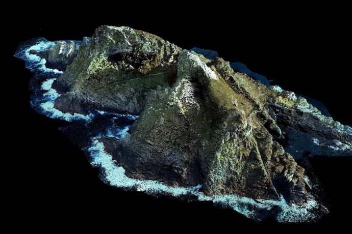
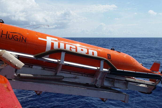
Fugro’s latest airborne lidar Geo-data contract supports Irish coastal resilience
Fugro has won a contract to capture high-resolution lidar Geo-data along Ireland’s southern and western coastline and create a detailed 3D elevation model. The project has been commissioned by the Office of Public Works (OPW), the lead agency for flood risk management in Ireland, to deliver a consistent, uniform and up-to-date baseline elevation model of this part of the Irish coast.
Fugro completes geohazard site investigation activity on Block 58 in Suriname
Fugro has finalised fieldwork on a site investigation programme for TotalEnergies off the north-west coast of Paramaribo in Block 58 of the Guyana-Suriname Basin
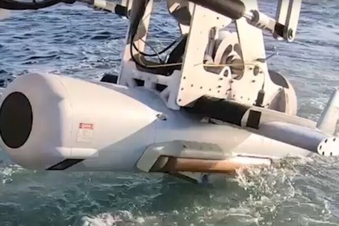
SeeByte and Raytheon combine AN/AQS-20C sonar with SeeTrack C2 software for real-time contact analysis
SeeByte and Raytheon Technologies are working together to bring Raytheon’s AN/AQS-20C advanced minehunting sonar system data into SeeByte’s SeeTrack v4, multi-domain command and control system.

UKHO and Teledyne CARIS partner with The Nippon Foundation-GEBCO Seabed 2030 project
The UK Hydrographic Office has entered a technical cooperation agreement with The Nippon Foundation-GEBCO Seabed 2030 Project and Teledyne CARIS, a leading developer of marine mapping software.

Supercharging science: an open letter from Dstl chief executive
Science lab urges best minds in industry, academia, engineering, science, and technology to work with UK specialists to combat future threats.
Become a member
We promote the interests of UK based companies in the international market place and to governments
Join Us See the BenefitsNewsletter Signup
Keep up to date with all the latest news and events with our regular newsletter delivered straight to your email box.
Sign Up NowMarine Autonomy Challenge (MAChallenge)
This exciting biennial challenge is open to teams of students studying at UK universities.
Learn more